The Texas Department of Transportation is undergoing project planning regarding the historic truss bridge at SH 332 over the Brazos River in Brazoria, located between SH 36 and FM 521 in Brazoria County. Some of you may have spoken to my colleague Julie Beaubien regarding this project yesterday. We've identified you as someone that is interested in the bridge's history. TxDOT is planning a stakeholder meeting on Thursday, November 16, 2017, from 5:30-7:30 PM at Barrow Elementary School, located at 112 Gaines Street in Brazoria, TX 77422 (see attached map).
We will be sharing a short presentation and presenting potential options for the future of this historic bridge moving forward. There will be a discussion afterward and we encourage you to provide your feedback. This is not a formal TxDOT hearing - just an opportunity for interested parties to talk to us, and for TxDOT to hear from you.
We would appreciate confirmation of your attendance; please let us know if you plan to attend no later than Tuesday, Nov. 14, 2017.
Thank you very much and hope to see you there! Please contact me with any questions.
Renee Benn
Houston District Historian
TxDOT Environmental Affairs division
125 E 11th St
Austin, TX 78701
512 416 2611
Welcome to BrazosBlog
BrazosBlog is dedicated to preserving the history of four bridges — past, present, and future — crossing the Brazos River at Brazoria, Texas:
Neal McLain
nmclain@annsgarden.com
Brazoria, Texas
Revised 06/02/2016
- The China Street Bridge, constructed in 1912; no longer extant except for the abandoned center-pivot pier.
- The first SH 332/FM 521 Highway Bridge, constructed in 1939 to replace the damaged China Street Bridge. No longer in use, it now stands abandoned next to the second SH332/FM521 bridge, a forlorn reminder of an earlier day.
- The UPRR Railroad Bridge, originally constructed by the St. Louis, Brownsville, and Mexico Railway Company and still in use today by the Union Pacific Railroad
- The second SH 332/FM 521 Highway Bridge, a "shovel-ready" project opened in 2013 to replace 1939 bridge.
Neal McLain
nmclain@annsgarden.com
Brazoria, Texas
Revised 06/02/2016
Brazos River
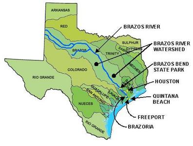
Tributaries of the Brazos River arise just across the Texas border in New Mexico. The river flows across most of the state of Texas, passing Brazos Bend State Park and the City of Brazoria before discharging into the Gulf of Mexico near Quintana Beach south of Freeport.
At 840 miles, the Brazos is the longest river in Texas, draining a watershed of 42,800 square miles. Worldatlas.com cites it as one of the twelve "major rivers" of North America.
Credit: U.S. Geological Survey, Texas Sites by Basin.
The City of Brazoria lies on the southwestern bank of the river, at the intersection of SH35 and FM521.
Credit: Wikimapia.org.
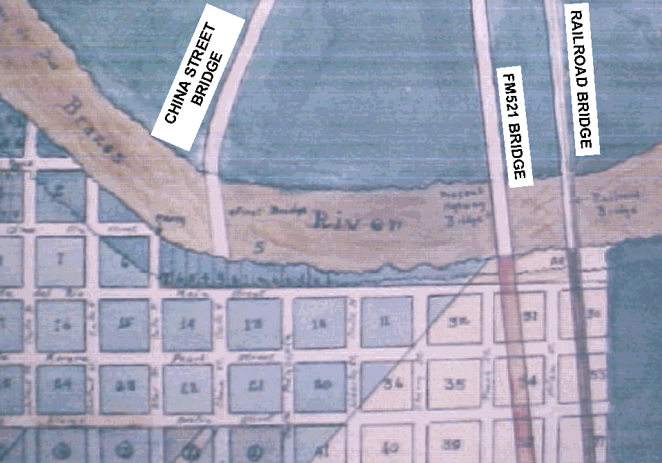
The following map shows the locations of the bridges with respect to historic streets.
Credit: Brazoria County Historical Museum.
The following map shows the locations of the two extant bridges and the China Street Bridge pier.
Credit: US Geological Survey map, 7.5-minute series, Brazoria quadrangle.
At 840 miles, the Brazos is the longest river in Texas, draining a watershed of 42,800 square miles. Worldatlas.com cites it as one of the twelve "major rivers" of North America.
Credit: U.S. Geological Survey, Texas Sites by Basin.

The City of Brazoria lies on the southwestern bank of the river, at the intersection of SH35 and FM521.
Credit: Wikimapia.org.
The following map shows the locations of the bridges with respect to historic streets.
Credit: Brazoria County Historical Museum.
The following map shows the locations of the two extant bridges and the China Street Bridge pier.
Credit: US Geological Survey map, 7.5-minute series, Brazoria quadrangle.

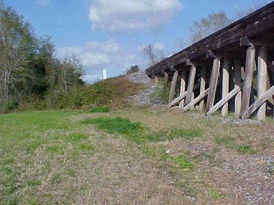
China Street Bridge
The China Street Bridge — the first bridge across the Brazos River at Brazoria — was a wood-decked center-pivot structure constructed in 1912. The following photo shows the bridge as it existing in the 1920s and 1930s.
The China Street bridge collapsed into the river in the 1930s during a period of high water, apparently due to failure of the southwest pier. The center-pivot pier is all that remains today. Although it was once in the center of the river, erosion of the southwest bank and deposition on the northeast bank has moved the river westerly, with the result that the pier is no longer in the center of the river.
 |
| Historic photograph of the China Street Bridge. Credit: Brazoria County Historical Museum |
 | |
The China Street Bridge pier as it exists today. Note that:
|
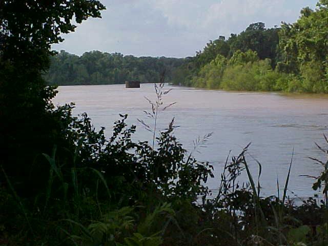 |
| The center pier as seen from the State Highway bridge, at high water. |
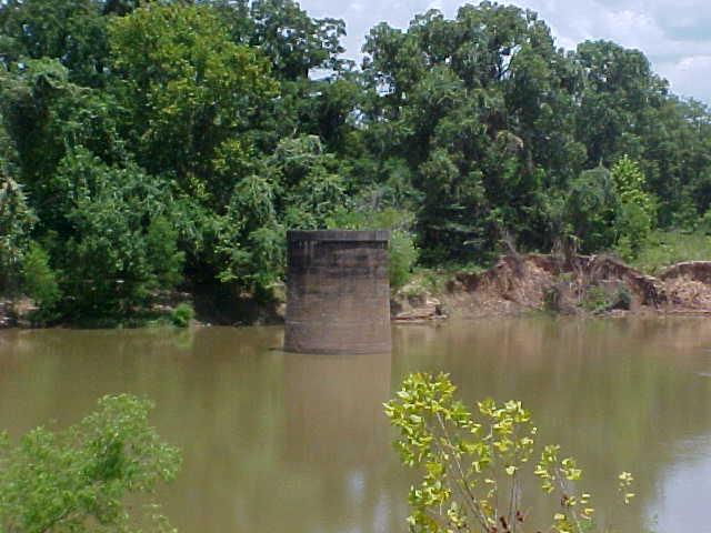 |
| The center pier from the southwest bank of the river, at low water |
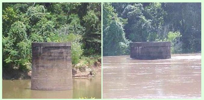 |
| The center pier from the southwest bank of the river at low and high water |
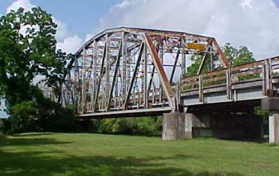
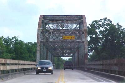
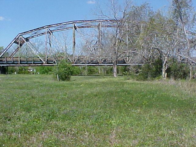
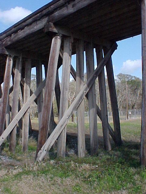
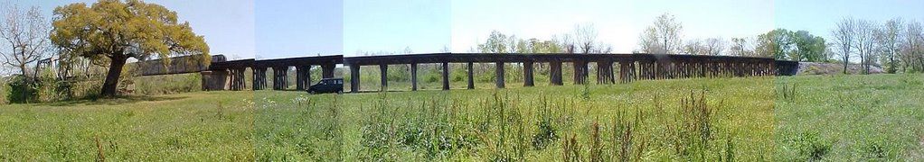
State Highway Bridge
The State Highway Bridge
(known for years as the "Brazos River
Bridge at Brazoria" or the "Brazoria Bridge") is a 1124-foot
concrete and steel structure containing three Parker truss spans. It's
a recorded Texas Historic Landmark, and it's listed in the National Register of Historic Places.
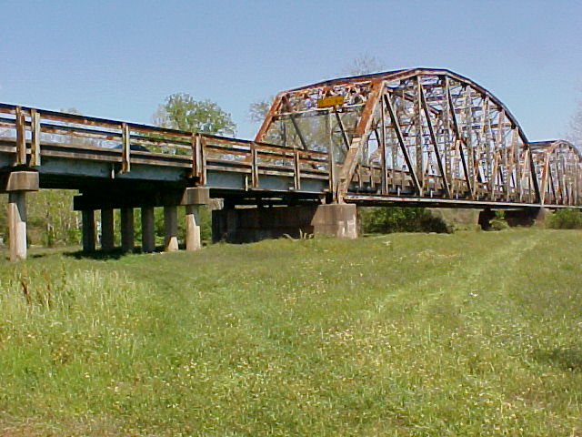
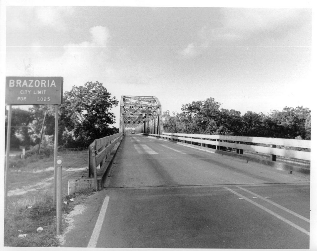
The Brazoria Bridge was constructed in 1939 to carry State Highways SH332 and FM521 across the Brazos River. Like the two highways that it carries, the bridge was owned by the State of Texas Department of Transportation (TXDOT).
After TXDOT completed the construction of the "New Brazoria Bridge" around 2010, the old bridge was abandoned and closed. Barriers were placed at both ends to block pedestrians.
For several years before the old bridge was closed, numerous plans were developed to use the bridge for pedestrian purposes. TXDOT offered to repaint the bridge and then donate it to Brazoria County or the City of Brazoria. The County Parks Department proposed a plan to use the bridge as part of a new county park.
All redevelopment plans fell through in the face of rising cost estimates. According to the Brazoria County News, the estimate for lead-paint remediation alone reached $5 million. See articles here and here.
Today the bridge stands forlornly next to the new bridge, blocked at both ends to prevent pedestrian use, slowly rusting away and dropping bits of lead paint into the river.
 |
| Southwest Approach viewed from west |
 |
| Satellite image of the Brazoria Bridge (left) and UPRR railroad bridge (right), before construction of the new Brazoria Bridge. The shadows of the three Parker trusses of the Brazoria Bridge are clearly visible in this image. Click image for current map. Source: Wikimapia. |
 |
| Markers on bridge truss |
 |
| FEDERAL EMERGENCY ADMINISTRATION OF PUBLIC WORKS FRANKLIN D. ROOSEVELT PRESIDENT OF THE UNITED STATES BRAZORIA BRIDGE 1939 |
 |
| FEDERAL EMERGENCY ADMINISTRATION OF PUBLIC WORKS FRANKLIN D. ROOSEVELT PRESIDENT OF THE UNITED STATES BRAZORIA BRIDGE 1939 (Digitally altered photo) |
 |
| BRAZORIA BRIDGE HAS BEEN LISTED IN THE NATIONAL REGISTER OF HISTORIC PLACES BY THE UNITED STATES DEPARTMENT OF THE INTERIOR 1991 |
 | |
| BRAZORIA BRIDGE HAS BEEN LISTED IN THE NATIONAL REGISTER OF HISTORIC PLACES BY THE UNITED STATES DEPARTMENT OF THE INTERIOR 1991 (Digitally altered photo) |
 |
| PRESENTED TO BRAZORIA COUNTY COUNTY JUDGE FLOYD WINSLOW - 1938 O.K.PHILLIPS -1939 J.C. MCKENZIE - CONS ENGINEER HAILE & McCLENDON - ASSOC CONS ENGRS KELIHER CONSTR. CO. - CONTRACTOR |
 |
| Bridge structure from the northeast, looking southwest |
 |
| Bridge structure from the northeast, looking southwest |
 |
| Bridge piers from the southwest, looking northeast, at low and high water |
 |
| Southwest approach, seen from the southeast |
 |
| Southwest approach, looking north. |
 |
| China Street bridge seen from Brazoria bridge. Credit: Brazoria County Historical Museum. |
 |
| Brazoria Bridge from southwest, looking northeast. Credit: Brazoria County Historical Museum |
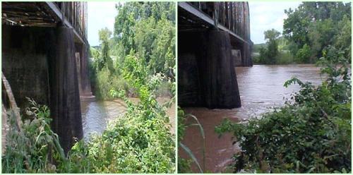
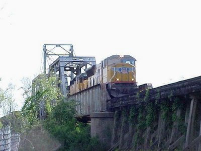
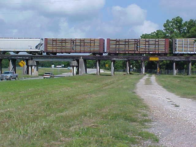
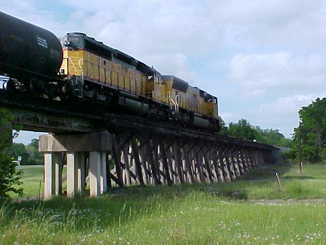
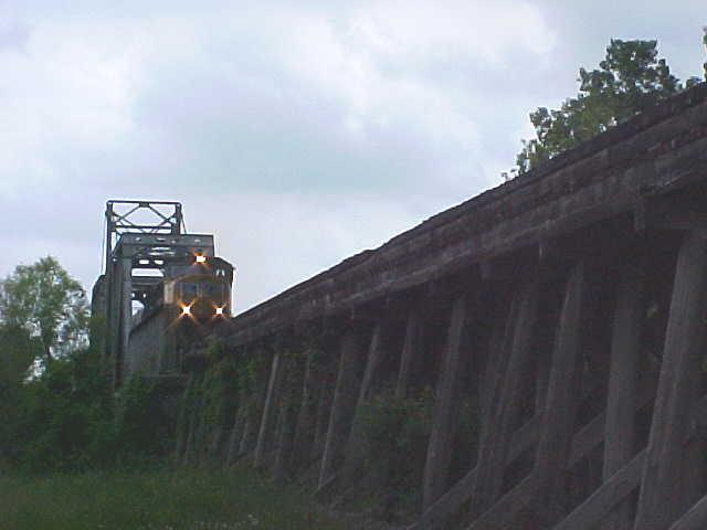
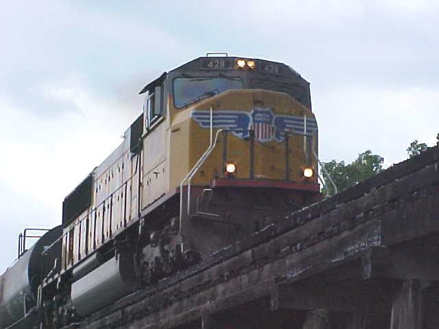
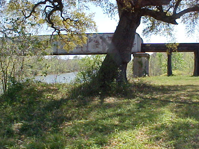
UPRR Railroad Bridge
Union Pacific Railroad Houston Area, Angleton Subdivision.
The UPRR Railroad Bridge was originally built ca 1907 by the St. Louis, Brownsville, and Mexico Railway Company. It's a center-pivot swing bridge, theoretically capable of pivoting to allow river traffic to pass, although it has not been opened for several years.
The SLBMRW merged with the Missouri Pacific Railroad Company in 1956, which in turn merged with the Union Pacific in 1997. The railroad operates today as the Union Pacific, which still uses the bridge for revenue traffic. A dozen trains a day pass across it, most of which are drawn by UPRR locomotives, although BNSF and KSC locomotives are sometimes seen.
The bridge carries the UPRR over the Brazos River near Brazoria, Texas. Heading north it passes Angleton yard, Danbury, and Liverpool, thence intersects the BNSF Railway Galveston subdivision in a large wye at Algoa Junction.
Heading south it passes through Brazoria, Sweeny, Abercrombie, Bay City, Blessing,Refugio, and numerous other communities before reaching Harlingen and Brownsville. A branch line at Abercrombie junction provides service to the Phillips 66 refinery northwest of City of Sweeny. At Brownsville it crosses the Brownsville & Matamoros International Bridge into Mexico.
 |
| UPRR Railroad Bridge as seen from the Brazoria Bridge about 2006, before construction of the new Brazoria Bridge. |
 |
| Satellite image of the Brazoria Bridge (left) and UPRR railroad bridge (right), before construction of the new Brazoria Bridge. The shadows of the three Parker Trusses of the Brazoria Bridge are clearly visible in this image. Click image for current map. Source: Wikimapia. |
 |
| Northeast approach as seen from the north |
 |
| Northeast approach as seen from the southeast |


 |
 Northeast approach as seen from the southeast |


 |
| Southwest approach as seen from the southeast. |
 |
| Southwest approach as seen from the southeast. Composite photo |
New State Bridge
The State of Texas Department of Transportation began to develop plans for a new concrete bridge several years before construction began. Construction finally began around 2006 with partial funding provided by the United States government. The new bridge crosses the Brazos River immediately southeast of, and parallel to, the 1939 Brazoria Bridge, and extends in a wide circular arc across the Union Pacific Railroad carrying SH 332 toward Lake Jackson. Ramps connect SH 332 to FM 521 in both directions.
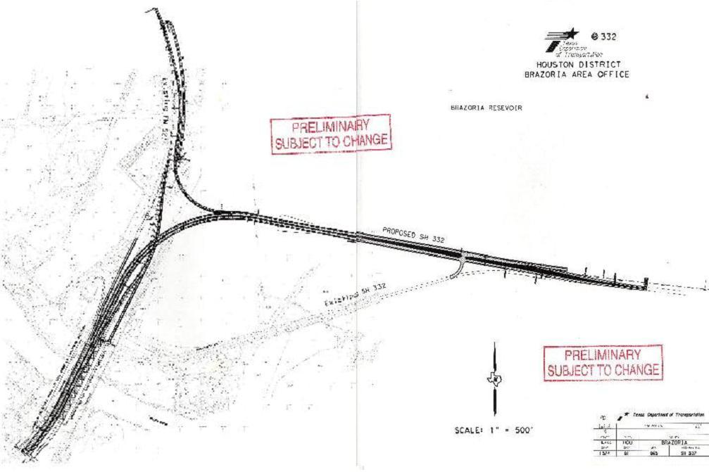 |
| Proposed Brazos River Bridge, 2005. Map provided by Texas DOT.. |
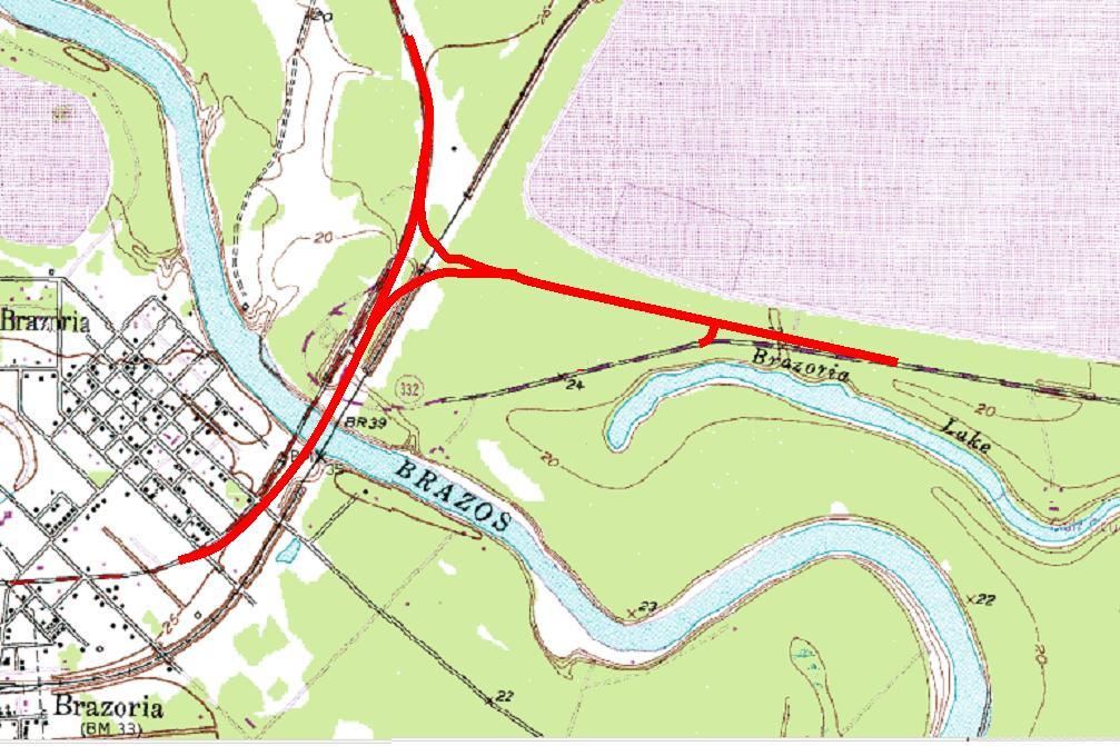 |
| The TXDOT design overlaid on the USGS National Map, Brazoria Quadrangle |


