At 840 miles, the Brazos is the longest river in Texas, draining a watershed of 42,800 square miles. Worldatlas.com cites it as one of the twelve "major rivers" of North America.
Credit: U.S. Geological Survey, Texas Sites by Basin.

The City of Brazoria lies on the southwestern bank of the river, at the intersection of SH35 and FM521.
Credit: Wikimapia.org.

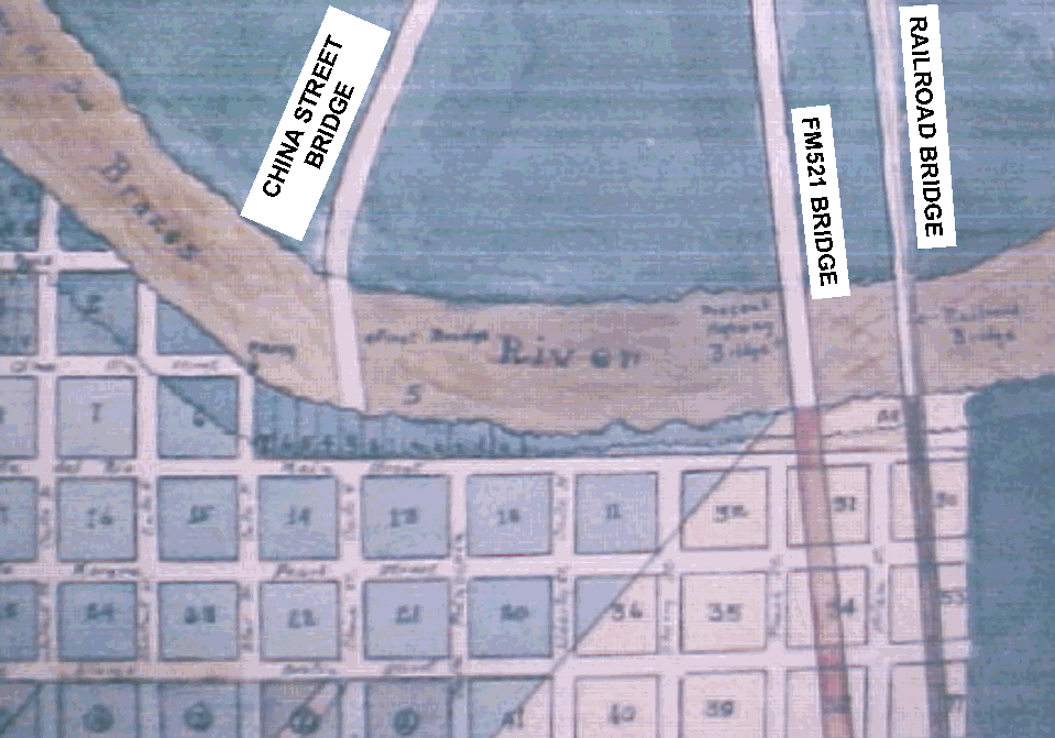
The following map shows the locations of the bridges with respect to historic streets.
Credit: Brazoria County Historical Museum.
The following map shows the locations of the two extant bridges and the China Street Bridge pier.
Credit: US Geological Survey map, 7.5-minute series, Brazoria quadrangle.
